Friday, May 31, 2013

Day 8, Boise

We used the time with Jeff and Miriam as a rest day. I did some work. Louis visited a bike shop for a repair. Bill, the mechanic, determined that Louis's chain was twisted and his derailleur was bent. A new derailleur and he was set to go. We had a nice lunch at the Big City Coffee. We picked up some groceries. Jeff fried catfish and French fries for dinner. Rocko is the Fitts's dog. They keep chickens.

We rode 12.15 miles @ 10 mph.

Bill working on Louis's bike
Louis and I relax on the back porch.
Jeff and Miriam Fitts and Rocko the Barbarian.


Chickens

Miriam's recipe for brisket, our first entree at her house. We ate like teenagers.

Day 7, Vale to Boise

3 mi @ 7.8 riding around town last night and to breakfast. Louis's odometer for the ride from Vale read 74 miles, giving us a grand total of 529.92 miles for the trip.

Another good day riding. The day started with a fantastic breakfast burrito at the Burger Barn. The wind was again generally at our backs and the temperature was great for biking. We entered Idaho. A good chunk of the ride was on quiet secondary roads that run parellel to major highways. We had lunch at the Caldwell pond. Google map tried to put us on a road that does not exist. With a few missteps we got back on track. We rode on the Interstate for 1/2 mile. We had our first experience with extending riding in semi-urban residential areas. We hit the 500 mile mark for the trip.

We stayed with Jeff and Miriam Fitts.

Here is a map of our general route: http://www.mapmyride.com/routes/view/246348869. It shows that our starting, maximum, and ending elevations were 2,246 ft. 2,920 ft., and 2,778 ft. We climbed 1,352 vertical ft. and had 1 class-5 climb.


Lunch on a pond


Wednesday, May 29, 2013

Day 6, Juntura to Vale

We rode 59.68 miles at 13.2 mph and then another 3 miles in Vale.

This was another glorious day. We followed the Malheur River or one of its branches most of the day and a strong breeze generally blow on our backs. We saw another golden eagle and white pelicans. Louis saw a prairie dog and two roadrunners. The first part of the trip was hilly. Then we entered flatter land that felt drier but had more arable land.

Here is a map of our general route: http://www.mapmyride.com/routes/view/246347445. It shows that our starting, maximum, and ending elevations were 2,916 ft., 3,225 ft, and 2,248 ft. We climbed 1,099 vertical ft. and had 1 class-5 climb.


Valel is famous for having thirty murals.


Riley to Juntura

86.64 miles @ 14.9 mph.

A great day of riding. Beautiful vistas. The land grew greener as we traveled east. The wind was at our back and we flew. A few moderate climbs and some grand descents. My maximum speed was 38.7

We saw another golden eagle.

The landlords at Riley told us that we could camp at Juntura. we met Miriam from Switzerland at the diner. Both Louis and I had Buffalo hamburger steaks.

Here is a map of our general route: http://www.mapmyride.com/routes/view/246343401. It shows that we started an an elevation of 4,216 ft and ended at 2,961 ft, with a maximum of 4,856 ft. We climbed 2,159 vertical ft and had 2 class-3 climbs and 1 class-5 climb.


Summit= 4804


Miriam


Monday, May 27, 2013

What a day

Day 4 was a ride from Bend to Riley. My odometer read 103.45 miles and it is a mile or two short. The average speed was 12.8 mph.

The day started with a ride into downtown Bend to meet Nicole. She helped serve us last night and agreed to learn more about what we could expect as we headed east and to ride with us out of Bend. We had breakfast, shopped, gathered our panniers, and headed east. After 20 miles she said goodby and headed back to Bend.

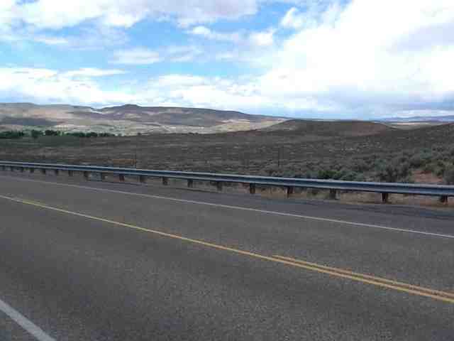
Louis and I trudged on. We knew that this stretch of rode did not have many options for camping, eating, or dining. The vistas were spectacular. Vast expanses of land punctuated by buttes and hills. We saw little wildlife. We did see a golden eagle.

Two hailstorms complicated our trip. The second occurred towards the end of the day, leaving us cold and wet, the bane of touring. When we reached the campground I thought would be our destination, we discovered that it was simply a place to bring campers, we did not see any tents. The two women who served us lunch at Brothers gave us the number to Riley. A quick call and we had a reservation for a room with kitchenette, Direct TV, and Internet. We proceeded to ride like men possessed for 7 more miles to reach Riley. We arrived with frozen hands and feet and enjoyed the best warm shower.

Here is a map of our general route: http://www.mapmyride.com/routes/view/246340575. It shows that we started at an elevation of 3636 ft, climbed 2090 vertical feet, and ended at 4216 ft. The maximum elevation was 4634 ft. We had 1 class-3 climb.

Louis and Nicole at breakfast 

Sunday, May 26, 2013

What to expect

I can see that my ability to maintain the blog is limited. Postings will come sporadically.

Also, Louis is taking more and better pictures than I can w my iPad. I will add them to posts later.

First Three Days

Day 1, 24 May
The trip began wonderfully. We took a short ride to the bus station using Portland's fantastic system of bike routes. I picked up subs from Subway for lunch while Louis held a spot in the line I feared but never formed. We loaded the bikes on the racks on the front of the bus and travelled to Tillamook. There we changed buses and went to Lincoln City. Three wonderful events occurred. First, we were able to store our bikes on the trip to Lincoln City in the luggage area at the back of the bipus because one of the racks was broken. Second, we changed our ultimate destination from Pacific City to Lincoln City based on the advice of a worker at Tillamook. She wanted us to avoid a narrow road used by logging trucks. Third, the worker gave us tokens to cover the extra cost.

It was a beautiful day of riding. Western Oregon is lush and verdant. 

We rode from Lincoln City to Salem, a total 59.84 miles, at 13.2 mph. Here is a map that shows our general route: http://www.mapmyride.com/routes/view/246146523. Our starting elevation was 91 ft and our finishing elevation was 234 ft. We climbed 1,846 vertical ft. Our maximum elevation was 938 ft. We had 2 class-5 climbs.

We stayed with Jon Steiner, a couch surfer. You can learn more about him at Jon.a.steiner@facebook.com.

Day 2, Sat 25 May
54.95 miles @ 11.8 mph. The mileage is a little short because my odometer acted badly. Louis had 56 miles. Lovely ride from Salem to Detroit State Park. Jon sent us off w great oat bran blueberry pancakes. We have talked about them repeatedly.

Here is a map of the general route we followed: http://www.mapmyride.com/routes/view/246156735. Some of the details in Salem may be incorrect. It shows we started at an elevation of 234 ft. and stopped at 1,619 ft, after climbing 2,392 vertical feet. We had 5 class-5 climbs. The maximum elevation was 1,900 ft.

Here are pictures in the ride of where we were and where we are going.

Here is a shot of Mount Jefferson from just west of our campsite. It is the white snow-capped peak in the center.

Day 3, 26 May
Detroit State Park to Bend. 83.6 miles @ 11.5 mph.

The day started rainy and varied between warm sunshine, cold drizzle, and all combinations. I think we hit sleet as we came down the backside of the Cascades. We broke camp in drizzle around 8 and road for almost two hours before reaching Marion Forks restaurant where we had a grand breakfast. The first 40 miles was mostly uphill, with the last 4 or so of them being the most intense. The reward was a series of spectacular views and a nice 6 mile descent after Santiam Pass. My maximum speed was over 31 mph.

The topology changed dramatically after crossing the mountain. Sagebrush replaced green moss and Ponderosa pine replaced cypress. Dry replaced wet.

We saw a bald eagle.

Here is a map of the route: http://www.mapmyride.com/routes/view/246161683. It shows that we started at an elevation of 1,619 ft. and ended at 3,636 ft after climbing 4,547 vertical feet. We had 2 class-3 climbs, and 5 class-5 climbs. The maximum elevation was 4,856 ft.


We dined at the Deschutes brew house. 

Travel day

Louis and I are on the plane leaving Charlotte. Malu drove us and everything went according to plan. I compliment Southwest Airlines. They were great. They took an oversized bike box and another bag as checked luggage for $75 and everyone was courteous and efficient.

The trip went well until we saw our boxes. They were crumbled and reaped with duct tape. The TSA had opened the boxes for inspection and undone two wonderful packing jobs. After an hour or so of nervous rebuilding our bikes, we thought that our bikes were fine.

We rode out of the airport into the rain to the home of Chris and Amy Koski. He left to attend a conference. She was a wonderful host.

We shared a beer with Cheston Knapp and his wife Alexis.

Louis at airport
My bike going into the plane
Louis after putting back together his bike
Preparing to leave the airport
My bike loaded and ready to roll
Cheston and Alexis

Tuesday, May 21, 2013

2nd haircut

I decided i wanted a shorter haircut. Someone in Richmond asked me why I was concerned about looks and, rhetorically, whether I would be trying to pick women on the bike trip. Malu has clippers to cut Louis's hair and cut mine with #2 all over. My hair sticks straight up and You can see skin

Sunday, May 19, 2013

Nelly Kate

Here I am at Louis's house on Saturday. His daughter preformed for us. Guests included Lisa, Skip, Louis's brother, Colin, Skip's son, Louis's mother, Zoe, Louis's daughter, and Malu (missing an accent), Louis's wife.

Louis's Mother
 

Skip, Louis's brother
Malu and crowd
Nelly Kate


Louis and I the next day